Census Tract Street Maps
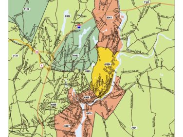
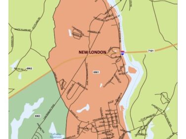
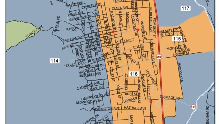
These maps show the streets and boundaries of any census tracts in your community. The maps use a color theme to depict the income classification of tracts according to the latest FFIEC bulletins.
Improve Your CRA Performance!
Many bankers use this as a tool to improve Community Reinvestment Act lending performance in LMI neighborhoods by distributing the maps to loan origination officers. This simple tool allows lenders to recognize the location of these areas by displaying the streets that form the boundaries of these tracts.
Need help?
Prefer speaking with a human to filling out a form? Call our corporate office and we will connect you with a team member who can help.
(203) 907-7497
© copyright 2024. All Rights Reserved


