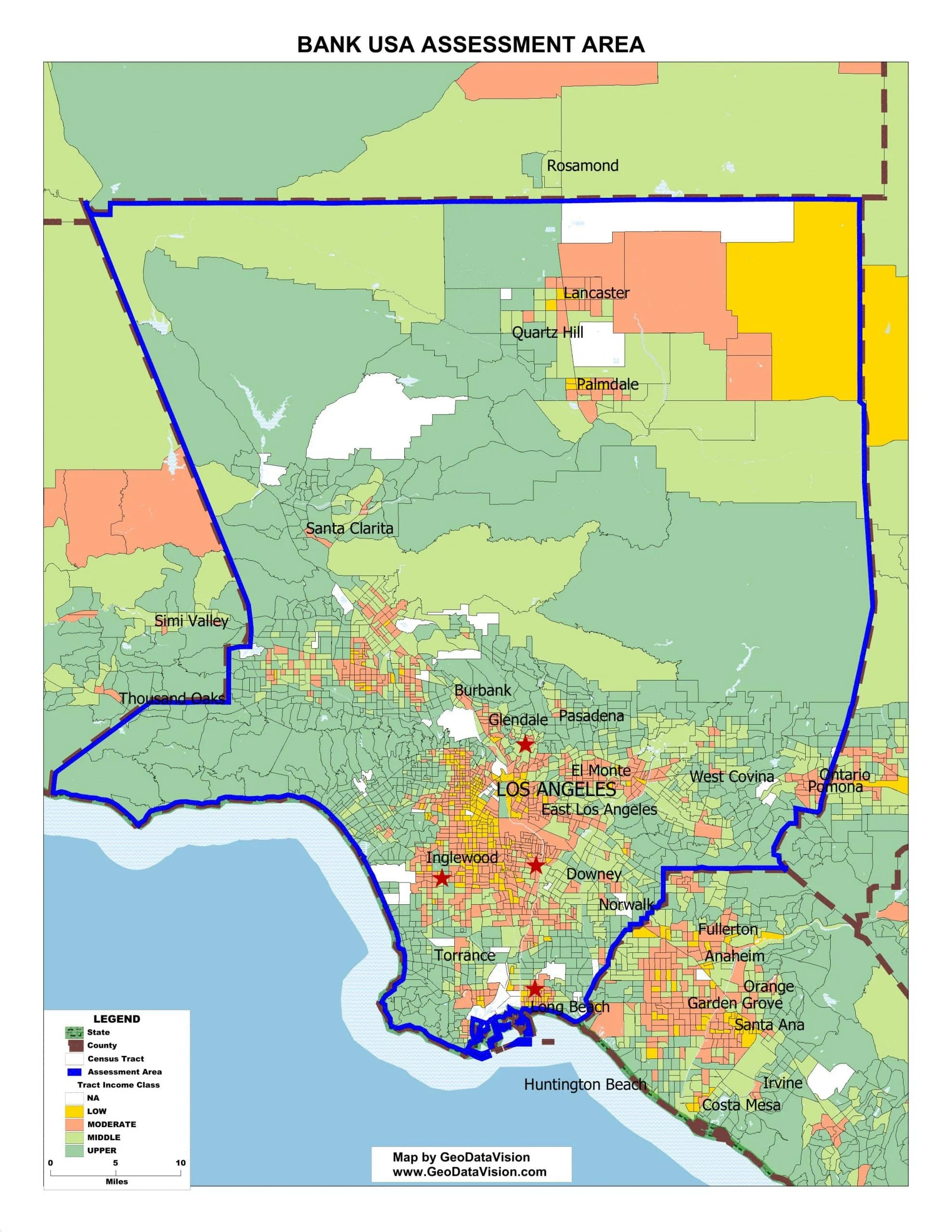
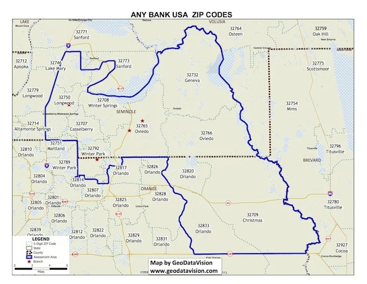
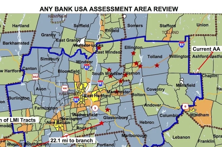
Assessment Area (AA) maps include the delineation of your Assessment Area boundaries, key towns and cities, major roads, census tract income classifications (color-coded) and branches. The map meets all regulatory standards for your CRA Public File.
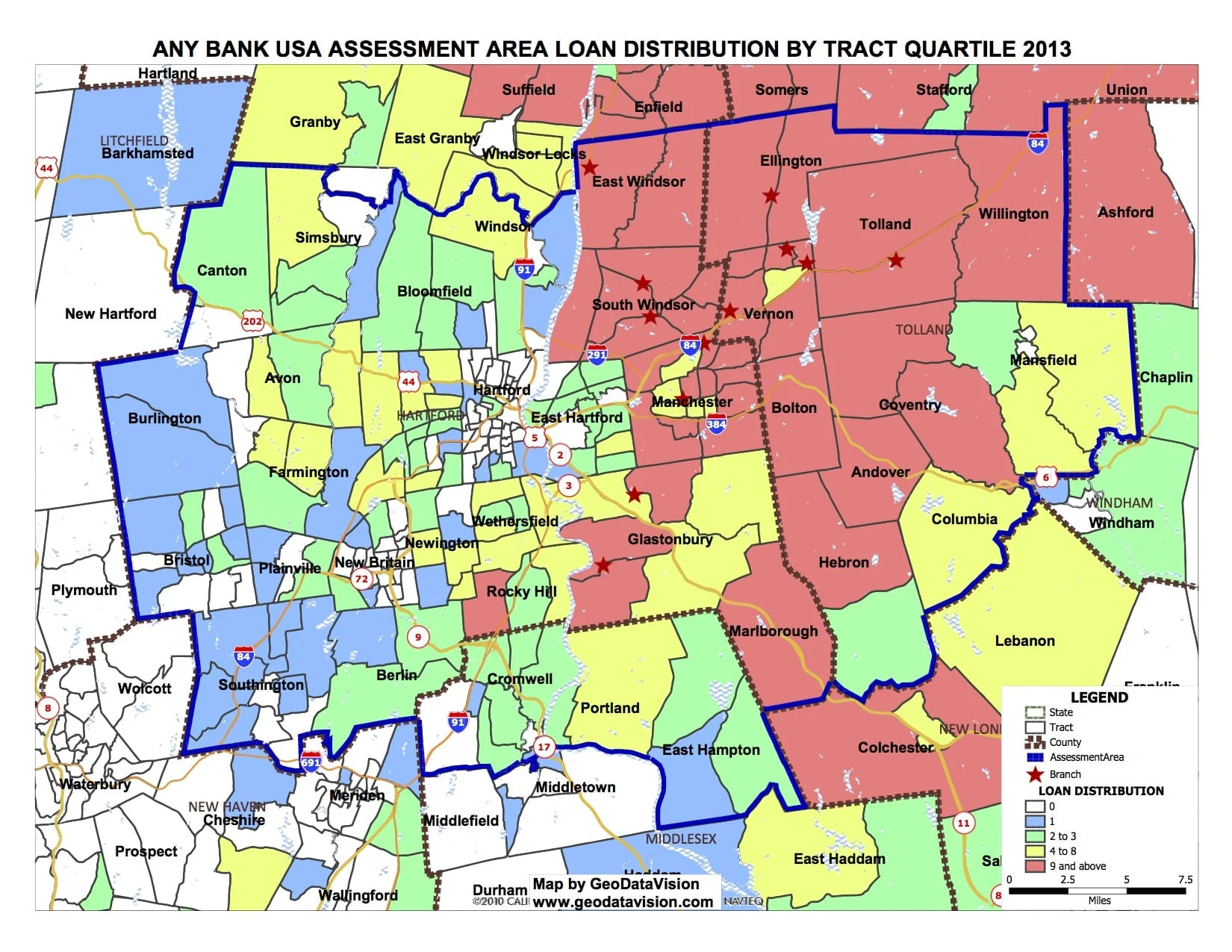
Depict your bank’s lending in and around your Assessment Area. “Single theme” and “double theme” maps display your lending activity (dollars and units) to reveal the geographic dispersion of your small business and mortgage lending.
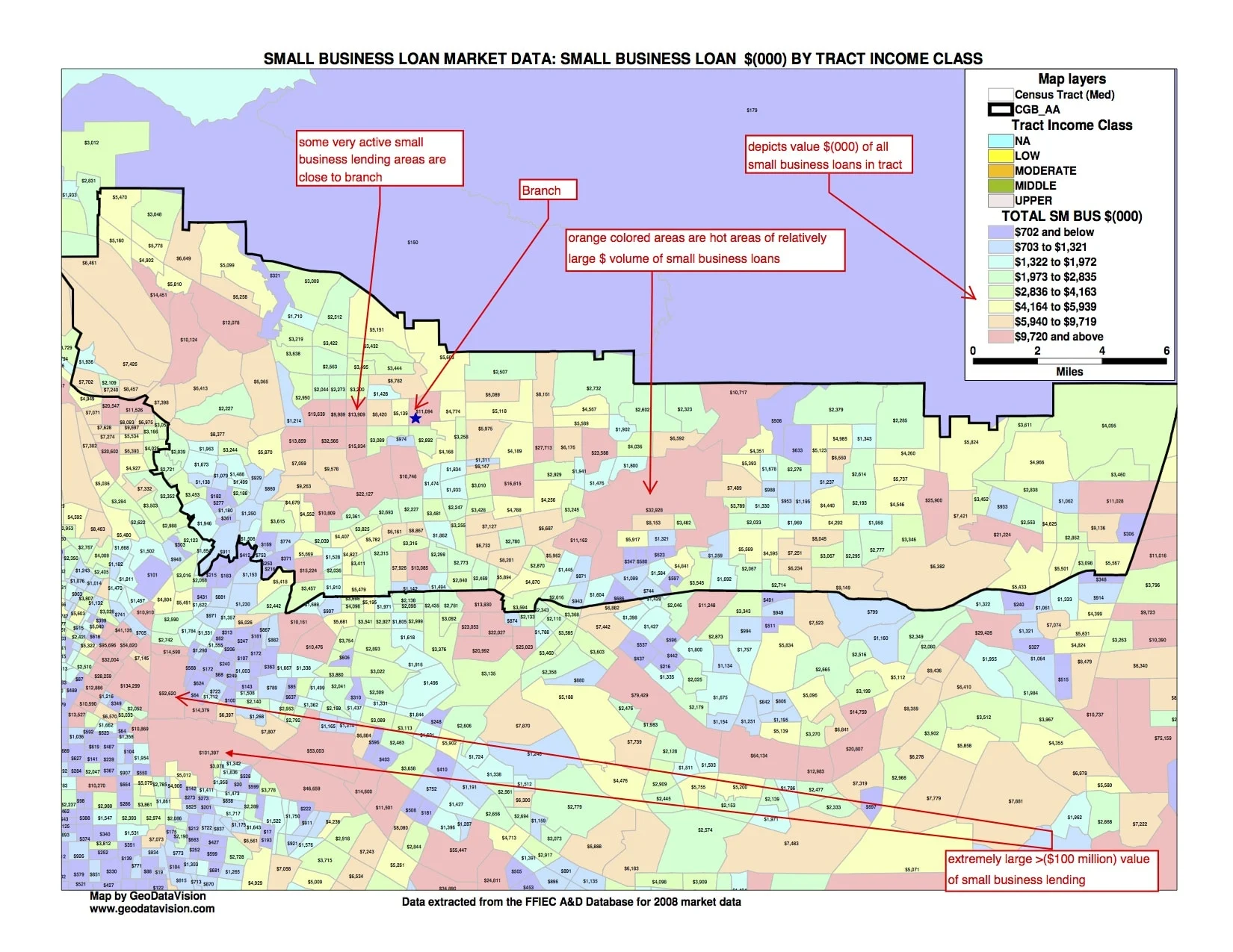
GeoDataVision creates maps of geographic areas (bank AA, county, etc.) and displays the market data (Small Business or HMDA) in units and dollars. The maps provide a geographic image of local mortgage and small business loan markets.
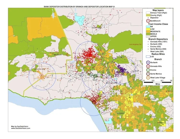
Mapping technology offers you the potential to visualize your market like never before. Mapping creates geographic pictures of your loans and deposits as well as competitor loans and deposits and branch locations. These “data pictures’ allow you to see and understand your markets like never before. Even more exciting, by combining mapping with live online meetings, any bank today, big or small, can enjoy the advantages of mapping their markets. Learn more about GeoDataVision Live Mapping Services.
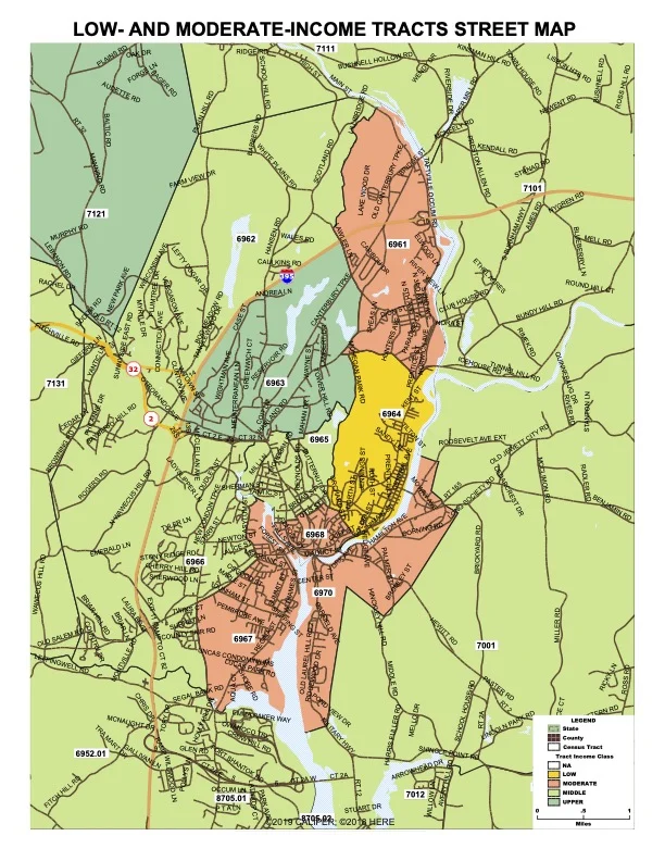
These maps show the streets and boundaries of any census tracts in your community. The maps use a color theme to depict the income classification of tracts according to the latest FFIEC bulletins.
Another use of AA Maps is to overlay zip code boundaries on them along with zip code numbers, for identifying their location in proximity to tracts, towns, counties, etc.
This is a unique GeoDataVision service that allows banks to use sophisticated mapping technology to analyze their markets. No mapping skills are required for you to take advantage of this service. GeoDataVision holds live online meetings during which a GeoDataVision professional works with live maps containing important market data that allow you to see your markets like never before. Having “active” maps offers exciting analytical options. Factors such as income demographics, minority population, mortgage market and small business loan market activity, “drive-time” analysis, and much more, can be viewed, adjusted and saved as map files for the bank to use.
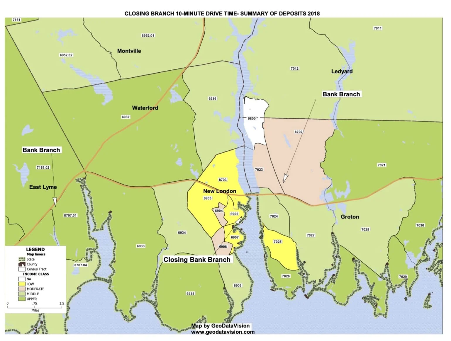
Maps that show how closing a branch affects the community it serves: nearby branches, drive times, deposits and the income level of the surrounding tracts.
Questions or pricing? Call (203) 907-7497 or send us a message.